|
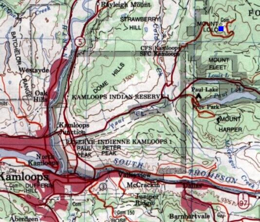
- (1998) The operations site was constructed on Mount Lolo northeast of the city of Kamloops, BC.
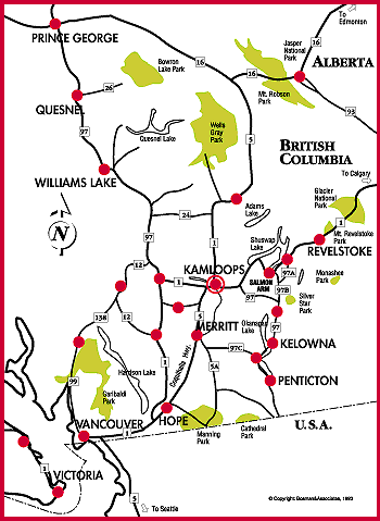
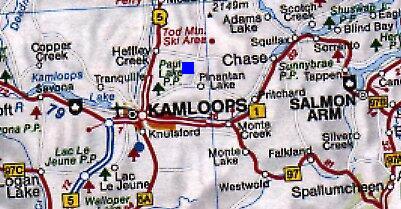
September 28th, 1997
The trip started from downtown Kamloops (by car) taking the Jasper Yellowhead Highway #5 north.
Look for road signs leading to Paul Lake Road. This road is located about 5 km north of Kamloops. There is a very large Husky gas station at the Paul Lake Road intersection. Make a right hand turn onto the Paul Lake Road.
It is 15.4 km (of paved road) from the highway intersection to the base camp (domestic site). It is a further 10 km (of gravel road) to the top of the hill where the operations area was located.
Once you start the drive on Paul Lake Road, there are a couple of turns:
At 9.8 km from the intersection, make a left hand turn at Cold Creek Road.
A further 1.3 km, make a right hand turn at Mount Lolo Road.
The remains of the domestic site are about 4.3 km from this intersection.
-- Ren L'Ecuyer, Victoria, BC
|